

Fadak Land Equipment Technology Knowledge-Based Company
Exclusive Distributor of SingularXYZ and SHARE in Iran
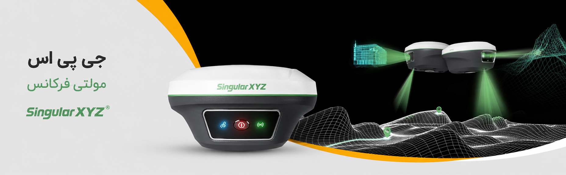
GNSS receivers are systems composed of an antenna, a microprocessor, and specialized software that can determine the three-dimensional coordinates of their position using signals received from satellites.
GNSS receivers serve a wide range of applications and are extensively used in geomatics sciences.
Depending on your project requirements and budget, you can choose the most suitable GNSS receiver from a wide variety of available models.
As one of the leading manufacturers in the GNSS receiver industry, Singular—holding internationally recognized quality and qualification certifications—is a reliable and trusted choice for your projects. With the support of its professional team, you can carry out your projects with high accuracy and efficiency.
Land Surveying (Topography)
Land surveying is a precise process used to collect data about the features of the earth’s surface, including elevations, depressions, boundary lines, and natural and man-made features. This process is essential for a wide range of engineering, construction, and urban and rural planning projects.
In land surveying, advanced instruments and modern techniques are used to collect data and produce topographic maps containing accurate information about point locations, distances, angles, and elevations. These maps are vital for the design and planning of civil engineering and construction projects.
Specialized land surveying services include:
Topographic surveying and preparation of accurate topographic maps
This process includes collecting data on the terrain’s elevations and depressions, natural features such as mountains, rivers, and lakes, as well as man-made features such as roads, buildings, and transmission lines. This information is fundamental for architectural, urban, and civil engineering design.
Use of advanced instruments (total stations, digital levels, and GNSS/GPS receivers)
To carry out accurate and up-to-date surveys, advanced digital tools are used, such as total stations for precise angle and distance measurements, GNSS/GPS receivers for accurate positioning, and surveying drones for aerial data acquisition and more detailed mapping in areas with limited access.
Setting out plans and executing earthwork operations
After topographic maps are prepared, the process of setting out designs and marking precise positions on the ground is carried out. This is essential for projects such as building construction, road construction, dam construction, and even precision agriculture planning.
Cadastral studies (boundary demarcation and land ownership registration)
Through land surveying, property boundary lines can be determined accurately, and cadastral maps can be prepared to establish land ownership and prevent legal disputes. These maps are essential for legal and administrative matters such as title deed issuance, boundary definition, and construction project implementation.
Surveying for specialized projects (road construction, dam construction, mining, oil and gas)
In large-scale projects such as road construction, dam construction, mining, and oil and gas projects, accurate surveying is essential for controlling different stages of construction and monitoring geological changes. This type of surveying includes precise elevation measurements, pipeline alignment, and monitoring volumetric changes in the terrain.
Monitoring and Evaluation of Changes Over Time
In long-term projects, monitoring and tracking changes in the ground and structures is essential. These services include assessing changes in ground surface levels, soil settlement, and horizontal or vertical movements in various structures.
Why Us?
Fadak’s sales and support team consists of experienced surveying engineers and graduates of the country’s reputable universities, who can recommend the most suitable tools and equipment based on your project requirements.
Aerial Surveying is one of the modern and advanced methods of spatial data acquisition that provides accurate and extensive information about the earth’s surface using aerial imagery. By utilizing drones, light aircraft, or satellite sensors, this technology enables topographic data collection, 3D modeling, environmental change monitoring, and the production of accurate and up-to-date maps.
Benefits and Applications:
High precision and wide coverage: the ability to capture data on a large scale with centimeter-level
Speed and efficiency: significant reduction in time and cost compared to traditional ground-based methods.
Access to hard-to-reach areas: suitable for mountainous, forested, or inaccessible regions.
Diverse applications: used in civil engineering projects, natural resources, precision agriculture, urban monitoring, environmental studies, and crisis management.
Methodology: In aerial surveying, after flight planning and establishing Ground Control Points (GCPs), imaging operations are carried out and the resulting images are processed using specialized software. The outputs of this process include orthophotos, Digital Elevation Models (DEM/DSM), point clouds, and accurate, analyzable maps.
Aerial surveying is a combination of technology, precision, and efficiency that has created a fundamental transformation in the geomatics and earth monitoring industry and is used as a key tool in strategic decision-making.
Aerial Surveying Group at Fadak Company
By utilizing professional drones equipped with photogrammetric sensors and LiDAR, we provide aerial surveying services with the highest level of accuracy and quality. This technology makes it possible to acquire spatial data rapidly, accurately, and safely from large and even difficult-to-access areas without the need for ground deployment.
Our capabilities and services in aerial surveying include:
High-accuracy OrthoPhoto Map production for generating base maps
Generation of Digital Elevation Models (DEM/DSM/DTM) for geomorphological analysis and civil engineering design
3D Mapping with centimeter-level accuracy for modeling natural and man-made features
Volumetric monitoring in mines, material stockpiles, and excavation/embankment projects
Monitoring changes in the earth’s surface over different time intervals for stability control and erosion assessment projects
Coverage mapping of agricultural and environmental areas for plant health analysis, vegetation density assessment, and natural resource management
Using specialized software such as Pix4D, Agisoft Metashape, Global Mapper, and ArcGIS, we convert raw aerial data into maps and analyzable information for engineers, project managers, and organizations.
Competitive Advantages of Fadak Aerial Surveying Group Services
– Surveys using multirotor and VTOL drones equipped with RTK/PPK to increase accuracy without the need for extensive GCPs
– Significant reduction in acquisition and processing time compared to ground-based methods
– High safety in projects located in hazardous or remote areas
– Capability to execute projects from small to very large scales
We are committed to delivering the most accurate and practical results to our clients by combining technical expertise, up-to-date equipment, and field experience.
For centuries, humans have used various tools for agricultural activities. Plows, sickles, hand cultivators, and other traditional tools were used in the past, whereas today modern equipment and machinery such as tractors and massive combine harvesters are widely used.
Technology is continuously and rapidly transforming agriculture, turning it from traditional practices into a fully industrialized sector.
One of the modern technologies that has brought a remarkable transformation to agriculture is GPS-based autonomous systems, which, when installed on agricultural machinery and even road construction equipment, significantly increase productivity.
An autonomous system is a combination of sensors, software, and navigation equipment installed on tractors, combines, or road construction machinery, enabling the vehicle to start operating without the need for a driver.
The main components of this system are:
GPS receiver: determines the precise location of the machine in the field and directs it to move accurately along the designated path.
Sensors: a set of tools including scanners, cameras, and others used for obstacle detection and mapping the target land.
Software: calculates movement patterns based on GPS and sensor data and sends motion commands to the tractor’s control systems.
Control systems: manage and guide the steering, braking, and engine components, allowing the tractor to move according to commands.
Advantages of autonomous tractors for the agricultural industry:
Increased efficiency: machinery can operate continuously, day and night, without the need for a driver or rest, which results in reduced time and increased productivity.
Cost reduction: with less need for human labor, autonomous tractors can significantly reduce costs.
Greater safety: machinery can eliminate risks associated with human error, such as fatigue and distraction, and improve safety in the workplace.
Data collection: autonomous tractors can gather valuable information about farm conditions, crop health, and machine performance, which helps with agricultural analysis and decision-making.
Greater sustainability: autonomous tractors can contribute to more sustainable agriculture by optimizing routes and reducing fuel consumption.
Challenges facing autonomous tractors:
– Higher cost compared to traditional tractors
– The need for farmer awareness, acceptance, and adoption
– Rapid technological change
– Lack of existing standards
Instrumentation refers to a set of equipment and systems used for measuring, controlling, and displaying physical and chemical quantities in various industries. These quantities may include pressure, temperature, level, flow, force, speed, humidity, voltage, and more.
What is the main function of instrumentation?
- Precise measurement of important parameters
- Monitoring and supervision of system conditions
- Automatic process control to improve accuracy and safety
- Operator notification and data logging
- Prevention of errors and hazards in industrial equipment
What are the applications of instrumentation in industry?
- Oil, gas, and petrochemical industries
- Power plants and energy production
- Food and pharmaceutical industries
- Factory automation
- Water and wastewater treatment plants
- Manufacturing factories and assembly lines
- Aerospace and marine industries
Why is instrumentation important?
- Improved production accuracy and quality
- Reduced maintenance costs
- Prevention of breakdowns and production line stoppages
- Greater worker safety
- Process automation and smart industrialization
Industrial Inclinometer
An industrial inclinometer is a precise and reliable sensor for measuring the angle and inclination of equipment in industrial environments. From heavy machinery to sensitive structures, this device ensures that operations are carried out with greater safety, higher accuracy, and full control.
Applications:
- Tilt control and rollover prevention for construction and mining machinery
- Monitoring the boom angle of cranes and lifting equipment
- Monitoring the inclination of tanks, towers, and industrial structures
- Use in robotics, automation, and production lines
- Precise tilt control in agricultural and road construction machinery
Advantages:
- High accuracy and stable performance under harsh conditions
- Easy installation and connectivity to PLC and monitoring systems
- Suitable for 24/7 monitoring of equipment and structures
- Increased safety and reduced operational risks
Fadak Company, with years of experience in the supply and sale of parachutes and their specialized materials, is recognized as one of the reliable suppliers in the aerial safety industry. Relying on technical expertise, a quality-oriented approach, and commitment to international standards, we provide a diverse range of parachute-related products from well-known European and Asian factories and brands to our customers in military, sports, research, and industrial sectors.
Our products include:
– Military and specialized parachutes: designed for maximum performance in harsh and high-risk conditions.
– Sports parachutes (skydiving): suitable for professional athletes with smooth and safe performance.
– High-tech parachute fabrics: durable, lightweight, waterproof, and compliant with international standards.
– Accessories: straps, hooks, ropes, and complementary parachute components suitable for special projects and specific applications.
– Customization based on project requirements: design and manufacture of parachutes or equipment according to your required specifications.
Automatic Activation Device (AAD)
– NYLON FABRIC MIL-C-7020
– NYLON FABRIC F111
– ZERO POROSITY NYLON RIPSTOP FABRIC W9001/ W9002
– NYLON WEBBING –9900/W9900R/W9910/
W9910R/W9920/W9920R/W9930/W9930R
– MIL-T-5661 T-2 – 1 1/2″ OLIVE DRAB
Why Fadak Company?
Owner of Meraj Air Sports Club
Exclusive representative of MarsJev
https://www.marsjev.com/en/iran
Guaranteed quality with specialized testing in accordance with PIA standards
Technical consultation and support for choosing the best option
Cooperation with international brands and suppliers
Fast response and on-time delivery
Our goal is to create safety and confidence in critical conditions. Trust us to give you a reliable experience at altitude.
Knowledge-Based Ground Equipment Technology Fadak Company
A leader in providing innovative surveying solutions and equipment, from design and production to sales and calibration.
As a trusted partner in meeting your needs in the field of surveying equipment, satellite receivers, total stations, laser distance meters, laser levels, and multi-frequency GPS systems, we are always by your side. With a focus on quality, reliability, and providing the best after-sales services, we aim to enhance efficiency and performance in your business. With Fadak, the trust we build on the ground is endless.
GPS Station Stability Status
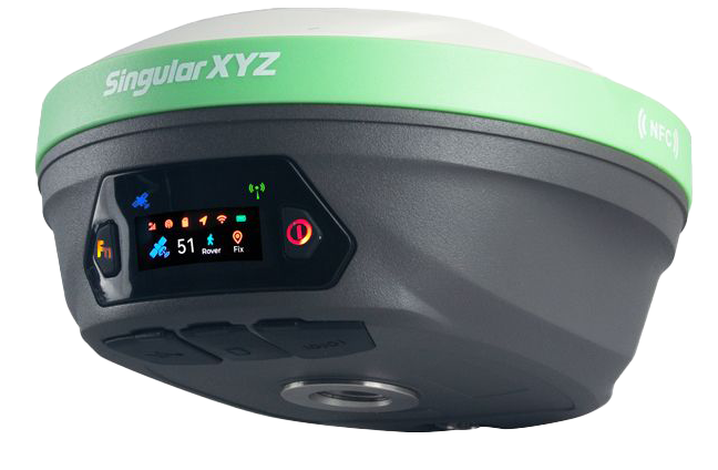
The X1 Pro, featuring waterproof capability, a large HD color display, light weight of 870 grams, NFC/Bluetooth, and more than 20 hours of battery life, is an excellent choice for you.
Get total station purchasing consultation at the best price from Fadak Ground Equipment Technology Company.
Total Station
Experience high-quality total station devices with Fadak!
Easy to Use
Unmatched Accuracy
High Speed

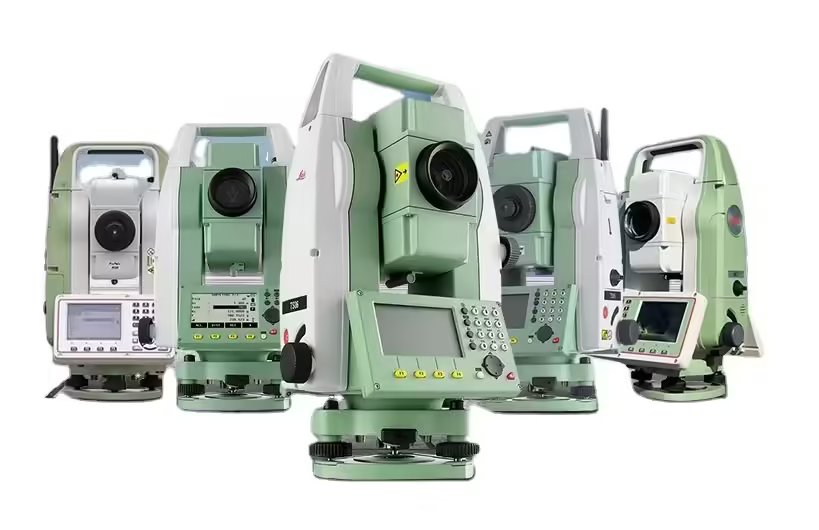
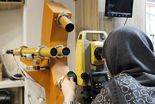
Surveying equipment is among the essential tools in construction projects and engineering processes. The accurate performance of these devices plays an important role in obtaining correct data and carrying out precise surveying operations. Therefore, regular and professional repair and calibration of surveying instruments are necessary to maintain data accuracy and ensure device performance.
At Fadak Surveying Equipment Company, by providing specialized repair services for surveying equipment (total stations, laser levels, laser distance meters, and multi-frequency GPS systems), we ensure that your device remains in the best operational condition. Our technical team, using up-to-date knowledge and extensive experience, is capable of resolving any technical issue in various surveying instruments.
Calibration at Fadak
Repairs at Fadak
At Knowledge-Based Ground Equipment Technology Fadak Company, we are proudly by your side. Our after-sales services include repairs, calibration, telephone support, product usage training, and troubleshooting. Contact Fadak Company to benefit from a high-quality purchasing experience and complete support.

