SAGRO150 AUTOMATED STEERING SYSTEM
±2.5CM AUTO-STEERING
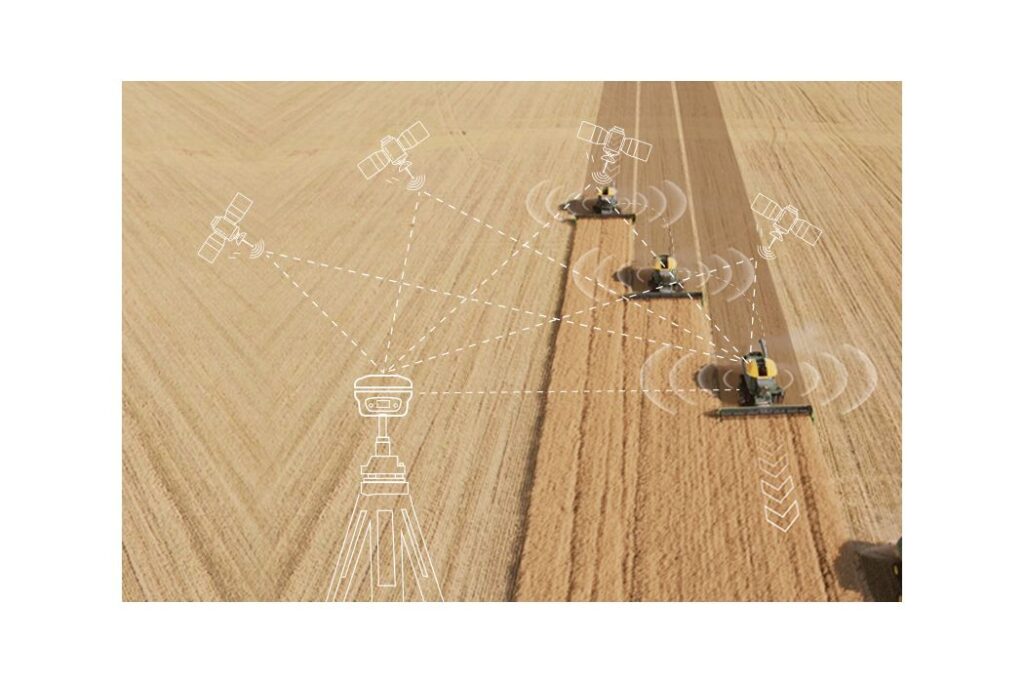
Embedded with high-precision full-constellation GNSS module, SAgro150 system provides ±2.5cm auto-steering accuracy, improving your farming efficiency and quality while freeing your hands.
ABUNDANT WORK MODES
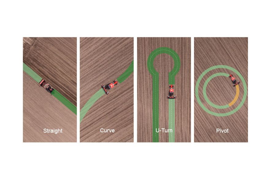
For different farm shape, terrain types and working tasks, SAgro150 software supports abundant work modes for your convenience, such as straight line, curve, U-turn, pivot, etc.
GET STARTED EASILY
Upgraded with single-antenna and dual-gyroscope design, users no longer need to assemble and install the antenna crossbar and angle sensor. SAgro150 system largely reduces the installation difficulty while enhancing the compatibility with different tractors.
HIGH COMPATIBILITY
Offering various spline sleeves for different tractor steering columns and the dual-gyroscope mode for different tractor types, SAgro150 system shows high compatibility with mainstream tractors in the market.
MULTIPLE TASK TYPES
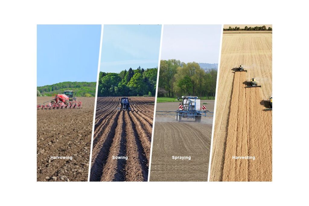
From spring to winter, from harrowing to sowing, spraying, and harvesting, farmers can set different implement types and working modes in SAgro150 to meet your farming needs throughout the year.
FARM MANAGEMENT
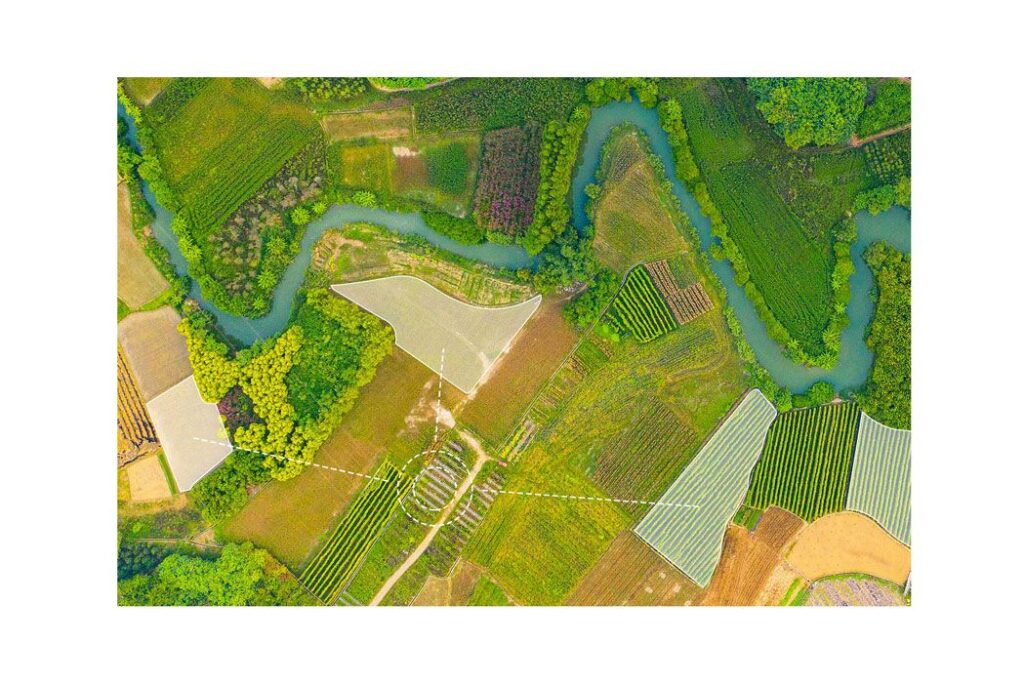
Smart farm management of SAgro150 system makes your farming more clear and less human errors. Farms and plots management is suitable for large farm owner. Real-time work records can clarify work progress and prevent duplication of work.
SYSTEM COMPONENTS
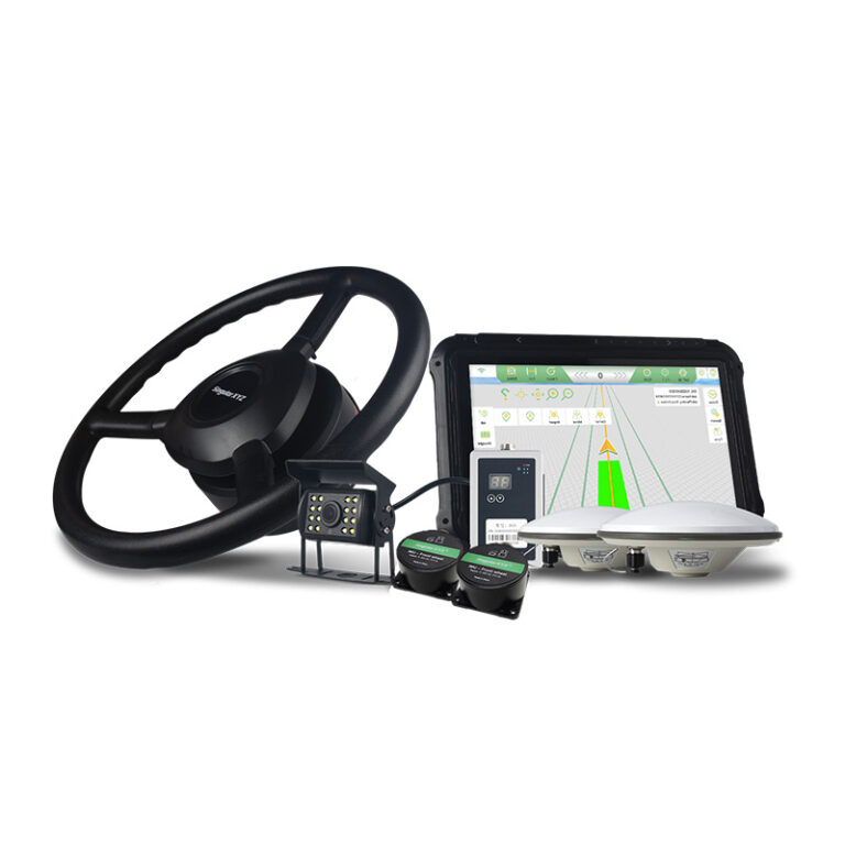
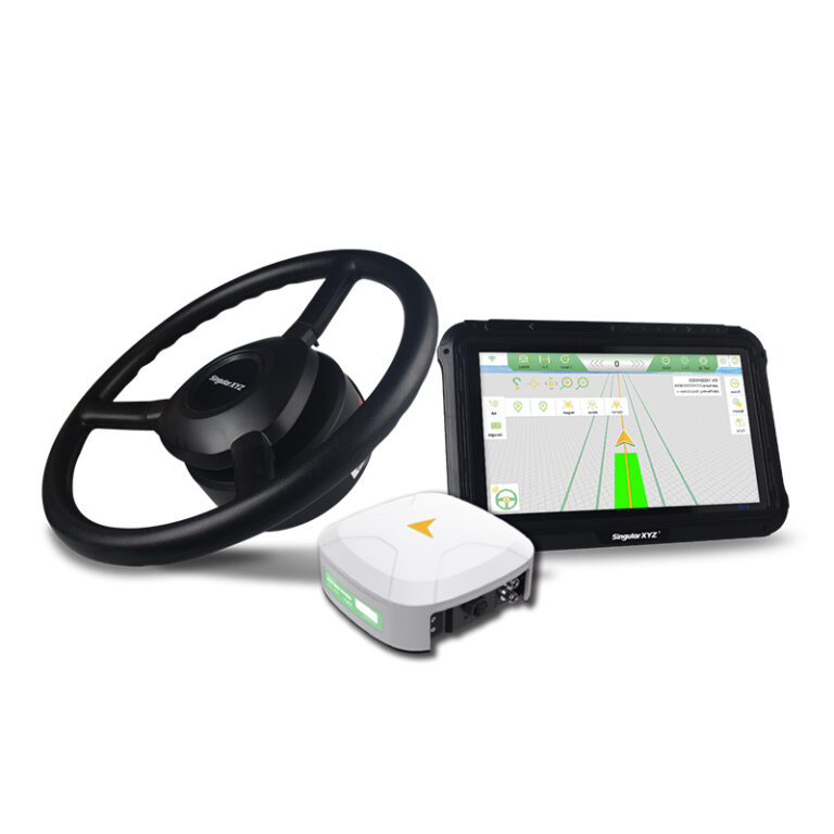
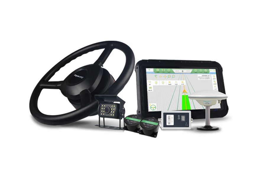
With T10 GNSS tablet for powerful calculation and operation, SA100 antenna for full-constellation signal receiving, high-torque SEM2 electric motor for sensitive steering control, SAgro150 system can provide you with stable and reliable farming experience.
HIGHER YIELD LESS COST
With SAgro150 auto-steering system, farmers do not need to concentrate on driving and can work continuously for longer, which means less fatigue and higher efficiency. The 2.5 cm accuracy also maximizes land use and yield while saving resources such as water and fertilizer.
SATELLITES TRACKING
Channels: 1408
GPS: L1C/A, L1C, L2C, L2P(Y), L5
BDS: B1I, B1C, B2a, B2I, B3I
GLONASS: G1, G2, G3
Galileo: E1, E5a, E5b, E6
QZSS: L1C/A, L1C, L2C, L5
NavIC: L5
SBAS: L1C/A
SBAS: WAAS, EGNOS, SDCM, BDSBAS, GAGAN
L-Band: Support
Cold start: <30s
RTK Initialization Time: <5s(typical)
RTK initialization reliability: >99.9%
Re-acquisition: <1s
ACCURACY
Standalone:
– 1.5m Horizontally
– 2.5m Vertically
DGPS:
– 0.4m Horizontally
– 0.8m VerticallyStatic post-processing:
Static post-processing:
– 2.5mm+0.5ppm Horizontally
– 5mm+0.5ppm Vertically
RTK:
– 8mm+1ppm Horizontally
– 15mm+1ppm Vertically
PPP:
– 5 cm Horizontally
– 10 cm Vertically
SBAS: < 1.0 m 3D RMS
Time Accuracy: 20ns
Tilt surveying: < ±2.5cm, within 60° tilt range
AR Stakeout:
– 8mm+1ppm Horizontally
– 15mm+1ppm Vertically
Laser Tilt Measurement: ≤5.5cm (5m range, ≤60°tilt in Laser mode)
DATA FORMAT
Data output format:
– NMEA-0183
– RINEX 3.02/3.04
– Binary format *.xyz
Data update rate: 1~50Hz selectable
Correction data format: RTCM v3.3/3.2/3.1/3.0
Supported protocols: Ntrip client, Ntrip Server, Ntrip Caster, TCP, UDP
COMMUNICATION
UHF modem1:
– Working range: 5km – 15km2, in ideal environments
– Frequency range: 410-470MHz
– Protocol (TX & RX): LoRa
– Protocol(RX):TRIMATLK, SATEL,TRANSEOT,TRIMMARK3, etc.
– Channel spacing: 25KHz
– Transmit power: 0.5W~2W selectable
Bluetooth: BT4.0 dual mode
NFC: Support NFC connection
WiFi: 802.11 a/b/g/n/ac
Interface:
– 1 Type-C interface for data transmission and charging
– 1 SMA connector for UHF antenna
VISUAL SENSOR
Sensor type: Camera
Pixel: Global shutter with 2 MP
Frame: 30 fps
FOV: 75°
Feature: Starlight-grade camera, HD capture in weak light environment
LASER SENSOR
Range: 10m
Accuracy: (3-5)mm + 1ppm
Measuring Frequency: 2Hz
Laser Injection Power: 2mW~3mW
Laser Tilt Measurement: ≤5.5cm (5m range, ≤60°tilt in Laser mod
USER INTERACTION
Front panel:
– 3 LED indicators indicating satellite tracking, differential data transmission and power
– 1 button for power on/off
WebUI:
– Accessible via Wi-Fi
– Support configuration, status checking, data transfer, data storage and system upgrade
ELECTRICAL
Power consumption: 1.8 W3
Input voltage: DC 5-15V
Battery:
– 4200 mAh, up to 12 hours working time
– Fast charge of 3 hours charging time DATA FORMAT
PHYSICAL
Size: Φ107 mm × 58.7 mm
Weight: 547 g
Storage: 8 GB4
Housing material: Magnesium-aluminum alloy
ENVIRONMENTAL
Working temperature: -40 ℃ to + 65 ℃
Storage temperature: -55 ℃ to + 85 ℃
Humidity: 100% non-condensing
Waterproof & dustproof: IP67
Drop: Designed to survive a 2m drop onto concrete
Note:
1. The enhanced UHF base is not compatible with normal UHF rovers on the market. For different user needs, SingularXYZ also provides normal UHF as an option compatible with UHF of other brands. Please clarify your requirements when placing the order.
2. The maximum working range of the enhanced UHF modem is 15km in ideal environments.
3. The power consumption varies with the different work modes.
4. Storage can be expanded to 32GB according to user demands.
All specifications are subject to change without notice.
