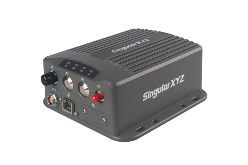
SV100 GNSS RECEIVER
FULL-CONSTELLATION
To ensure superior GNSS performance in all application scenarios, SV100 is equipped with a high-precision GNSS engine for simultaneously tracking GPS, BDS, GLONASS, Galileo & QZSS. Embedded with multi-frequency anti-jamming technology, SV100 offers high quality and stable GNSS data.
FLEXIBLE
CONFIGURATION
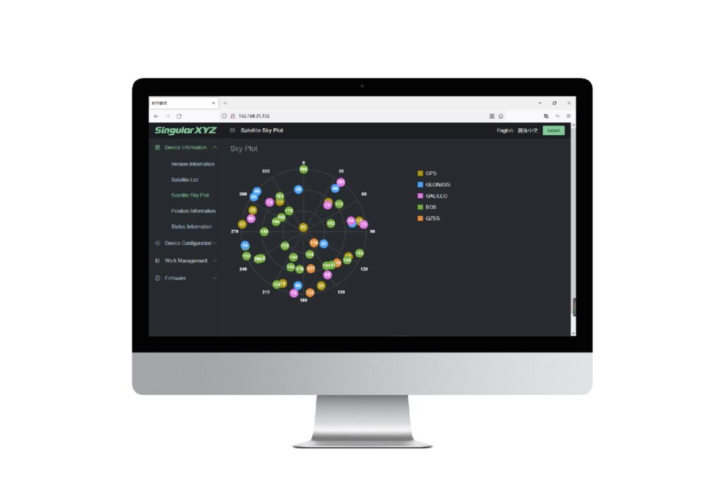
For professional users of reference stations, the web UI accessed via Ethernet/ WiFi contains comprehensive status display, working modes and data transfer settings. For field users of portable base stations, SingularXYZ also provides an android app connected via Bluetooth, offering a clean interface for necessary functions.
24/7CONTINUOUS
OPERATION
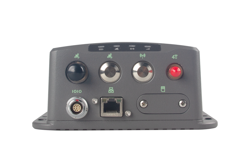
Except for the external power supply, SV100 is also optional for a 6600mAh battery to avoid sudden power failure or voltage instability. With a 4G network as the backup for Ethernet, and an MTBF of over 20,000 hours, SV100 guarantees your ultra-stable continuous reference station.
CORRECTIONS
TRANSMISSION
When broadcasting correction data as a portable base, users can select to insert the SIM card to transmit via 4G, or connect the UHF antenna to transmit via radio. SV100 supports multiple radio protocols to compatible with your RTK receivers, such as TRIMATLK, TRANSEOT, SATEL, TRIMMARK3, etc.

ONE DEVICE, DUAL PURPOSE
With a stable choke ring antenna installed outdoors, SV100 can serve as a reference station, providing stable GNSS raw data for CORS network or deformation monitoring. In addition, with the detachable hook, SV100 can also be easily attached to the tripod as a portable base station for your construction site or precision agriculture.
RUGGED HOUSING
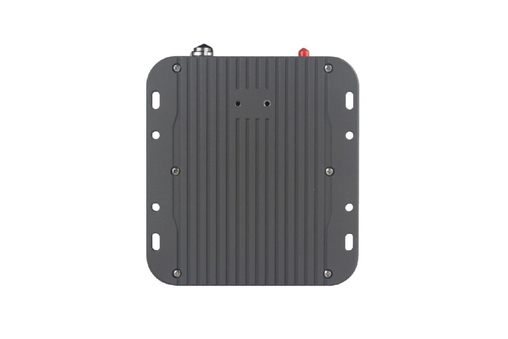
Considering various working environments, the SV100 is protected with rugged housing. IP67 waterproof and dustproof design, suitable for outdoor work in all kinds of weather. Aluminum alloy housing and compact structure to avoid accidental drop damage.
CUSTOMIZED
APPEARANCE
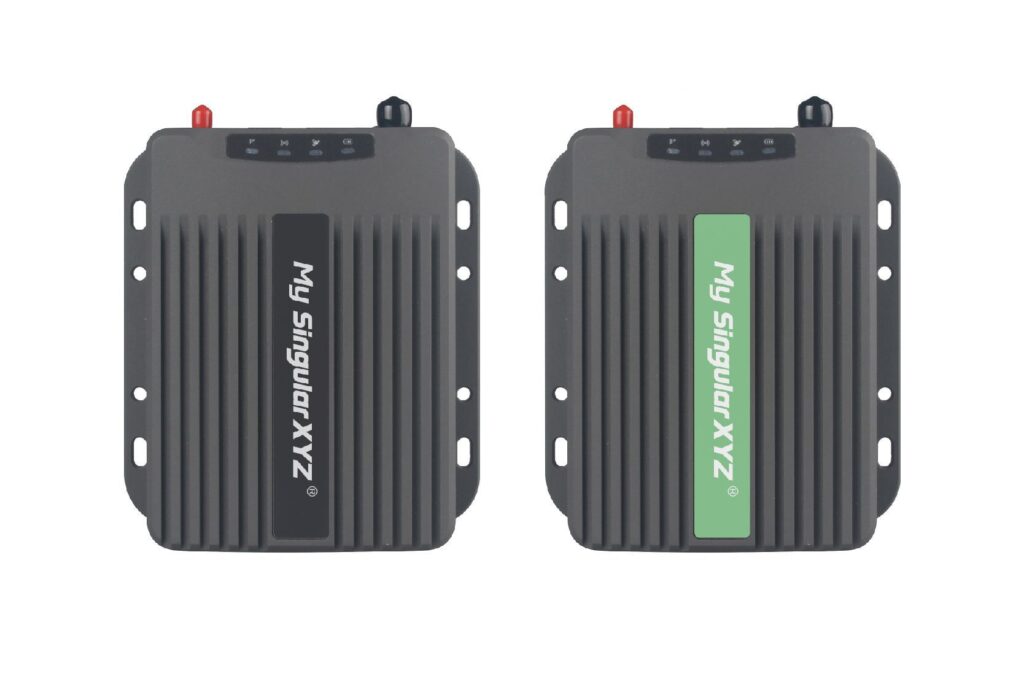
In order to meet the personalized customization needs of users, the top label of the SV100 GNSS receiver can be customized with different colors, texts and designs according to your preferences.
RTK BRIDGE
In addition to the reference station and portable base, the SV100 GNSS receiver can also work as a RTK bridge. For projects that requires uniform coordinate systems of local CORS, SV100 can connect to the CORS via 4G and broadcast correction data to the project site, largely saving your cost.
SATELLITES TRACKING
Channels: 1408
GPS: L1C/A, L1C, L2C, L2P(Y), L5
BDS: B1I, B1C, B2a, B2I, B3I
GLONASS: G1, G2, G3
Galileo: E1, E5a, E5b, E6
QZSS: L1C/A, L1C, L2C, L5
NavIC: L5
SBAS: L1C/A
SBAS: WAAS, EGNOS, SDCM, BDSBAS, GAGAN
L-Band: Support
Cold start: <30s
RTK Initialization Time: <5s(typical)
RTK initialization reliability: >99.9%
Re-acquisition: <1s
ACCURACY
Standalone:
– 1.5m Horizontally
– 2.5m Vertically
DGPS:
– 0.4m Horizontally
– 0.8m VerticallyStatic post-processing:
Static post-processing:
– 2.5mm+0.5ppm Horizontally
– 5mm+0.5ppm Vertically
RTK:
– 8mm+1ppm Horizontally
– 15mm+1ppm Vertically
PPP:
– 5 cm Horizontally
– 10 cm Vertically
SBAS: < 1.0 m 3D RMS
Time Accuracy: 20ns
Tilt surveying: < ±2.5cm, within 60° tilt range
AR Stakeout:
– 8mm+1ppm Horizontally
– 15mm+1ppm Vertically
Laser Tilt Measurement: ≤5.5cm (5m range, ≤60°tilt in Laser mode)
DATA FORMAT
Data output format:
– NMEA-0183
– RINEX 3.02/3.04
– Binary format *.xyz
Data update rate: 1~50Hz selectable
Correction data format: RTCM v3.3/3.2/3.1/3.0
Supported protocols: Ntrip client, Ntrip Server, Ntrip Caster, TCP, UDP
COMMUNICATION
UHF modem1:
– Working range: 5km – 15km2, in ideal environments
– Frequency range: 410-470MHz
– Protocol (TX & RX): LoRa
– Protocol(RX):TRIMATLK, SATEL,TRANSEOT,TRIMMARK3, etc.
– Channel spacing: 25KHz
– Transmit power: 0.5W~2W selectable
Bluetooth: BT4.0 dual mode
NFC: Support NFC connection
WiFi: 802.11 a/b/g/n/ac
Interface:
– 1 Type-C interface for data transmission and charging
– 1 SMA connector for UHF antenna
VISUAL SENSOR
Sensor type: Camera
Pixel: Global shutter with 2 MP
Frame: 30 fps
FOV: 75°
Feature: Starlight-grade camera, HD capture in weak light environment
LASER SENSOR
Range: 10m
Accuracy: (3-5)mm + 1ppm
Measuring Frequency: 2Hz
Laser Injection Power: 2mW~3mW
Laser Tilt Measurement: ≤5.5cm (5m range, ≤60°tilt in Laser mod
USER INTERACTION
Front panel:
– 3 LED indicators indicating satellite tracking, differential data transmission and power
– 1 button for power on/off
WebUI:
– Accessible via Wi-Fi
– Support configuration, status checking, data transfer, data storage and system upgrade
ELECTRICAL
Power consumption: 1.8 W3
Input voltage: DC 5-15V
Battery:
– 4200 mAh, up to 12 hours working time
– Fast charge of 3 hours charging time DATA FORMAT
PHYSICAL
Size: Φ107 mm × 58.7 mm
Weight: 547 g
Storage: 8 GB4
Housing material: Magnesium-aluminum alloy
ENVIRONMENTAL
Working temperature: -40 ℃ to + 65 ℃
Storage temperature: -55 ℃ to + 85 ℃
Humidity: 100% non-condensing
Waterproof & dustproof: IP67
Drop: Designed to survive a 2m drop onto concrete
Note:
1. The enhanced UHF base is not compatible with normal UHF rovers on the market. For different user needs, SingularXYZ also provides normal UHF as an option compatible with UHF of other brands. Please clarify your requirements when placing the order.
2. The maximum working range of the enhanced UHF modem is 15km in ideal environments.
3. The power consumption varies with the different work modes.
4. Storage can be expanded to 32GB according to user demands.
All specifications are subject to change without notice.
